Bartang Valley
The Bartang is part of the longest river system in Gorno-Badakhshan: starting as the Aksu in south-east Murghab district, it becomes the Murghab after joining with the Akbaital river north of Murghab town, and then the Bartang after passing through lake Sarez and joining with the Gudara river near Savnob. The Bartang is a very beautiful valley with narrow and steep sides and varied scenery at each bend in the river. The Bartangis are very hospitable people, and have succeeded better than most in preserving local traditions of music and dancing. The population of Rushan district is approximately 25,000.
Vomar, the district centre (also known as Rushan), lies just below the confluence of the Bartang and the Panj. Regrettably, the fortress occupied by the representatives of the Emirate of Bukhara until they were ousted by the Russians in 1905 was allowed – as so often happens when there is no local awareness of the importance of preserving historical and cultural heritage – to fall into ruins and the stones were used for other purposes. There is, however, a shrine in Vomar, ‘Ostoni Sayyid Jalol’, that is distinguished by its old and beautiful trees, and another nearby in Langar, above the confluence of the Vomardara, ‘Sho-Tolib’.
A little further south of Vomar, above the village of Past-khuf on the road to Khorog, is the village of Khuf, where there is another shrine, ‘Mustansiri Billoh’, and the ruins of a 19th century fortress. The road up to Khuf has good views of the Panj valley and passes a disused goldmine. The valley above Khuf is a good area for a short walk. About ten kilometres further up the Panj from Pasthuf towards Khorog, there is the village of Past-bajuv, offering a delightful walk (or a high drive) to the village of Bajuv above. You can also do a high walk between Bajuv and Khuf and from Khuf to Ridde in the Bartang valley.
In Yemts, the second village up the Bartang, there is a shrine, ‘Mushkilkusho’, and the ruins of a small fortress. From Khijez village, a little further upstream on the left bank, a trekking route goes up the right bank of Ravmeddara to the village of Ravmed (where there is also a shrine) and to the foot of the Patkhor Peak (6,083m). In the next village on the left bank, Visav, there are the remains of a 19thcentury fortress. Just beyond Visav is the main village of the Bartang, Siponj (sometimes referred as ‘Bartang’). In Siponj there is a tomb close to the village school known as Bobo Alisho, which is supposedly the tomb of Ali. There are other similar tombs in Khuf and Derzud in Rushan district. There are several caves above Siponj, that served in the 19th century and earlier as refuge from marauders, particularly from slave hunters from Afghanistan.
There is a shrine in Basid, ‘Mazor Khodja Nuruddin’ and, a few kilometres beyond Basid, there is a side valley to the right that leads up to the beautiful village of Bardara, with splendid views of the mountains beyond. The shrine ‘Chanorho’ (‘Sacred trees’) is built close to two old trees that are identical to those in other parts of Gorno-Badakhshan (e.g. at the shrine of Said Jalol in Vomar). Further up the Bartang, at Nisur, a road leads off to the right to the pretty village of Barchidev on the Murghab river, from which a path leads up to the Sarez lake. The fortress at Nisur was almost totally destroyed by an earthquake, but in Savnob, the next village up the Bartang, the ruins of a fortress still stand. In the 19th century Savnob was known as Tashkurgan (‘stone tower’) because of the fortress located there. The ruins of another 19th century fortress can be seen in Roshorv, which offers splendid views of Peak Lapnazar (5,990m).
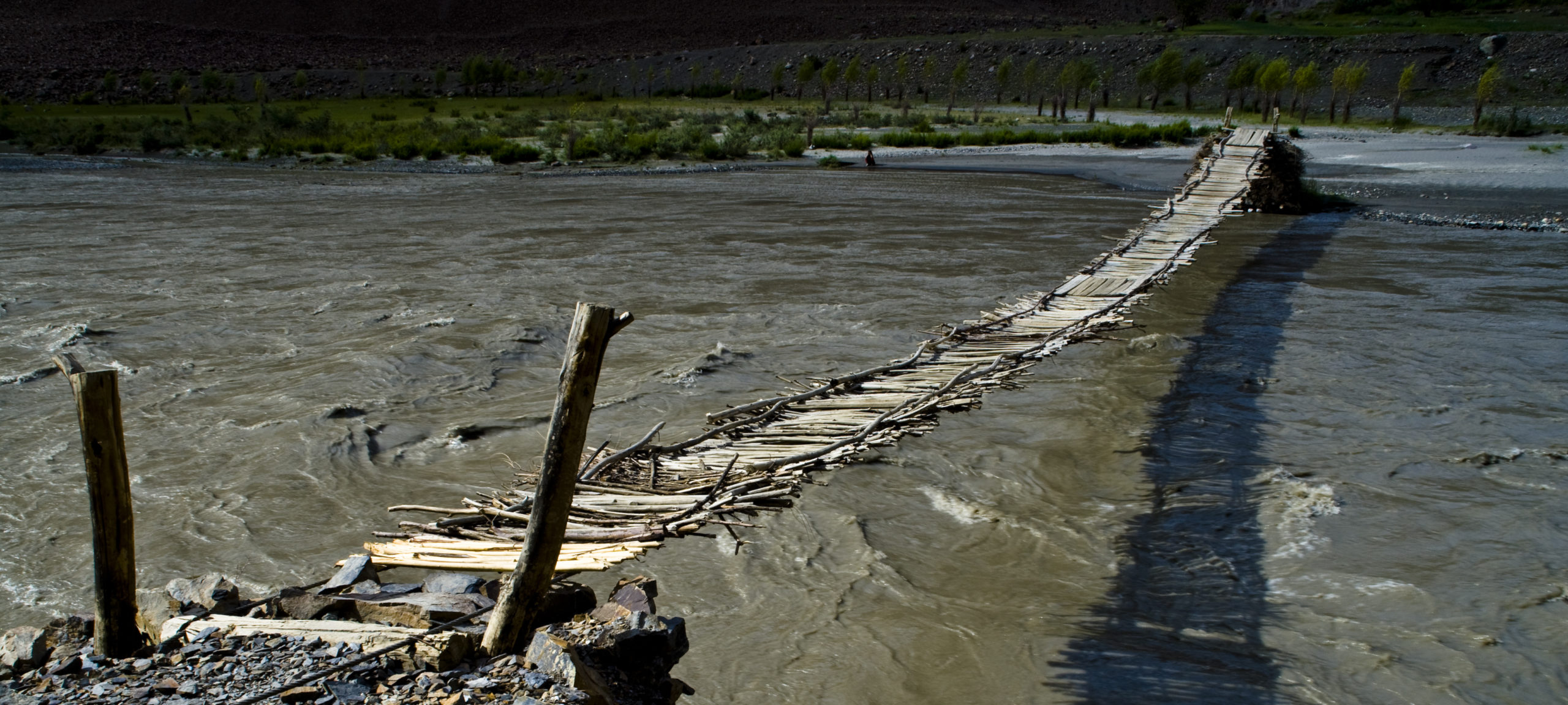
In Rukhch, just beyond Savnob, the fortress no longer exists but in both villages there are caves that provided refuge to the local population from Afghan and Kyrgyz marauders. In Pasor, the next village there is a shrine. From Pasor a trekking route goes up over a pass to the lower Grum-Grzhimailo Glacier and from Ghudara, the last village in the valley, a track leads up the Tanimas river, and then up the Kokuibel river valley (passing en route a solar calendar in Shurali) to the Pamir Highway near Lake Karakul (N.B. the road is not maintained and is probably no longer passable by jeep).
Jisev Valley


Lower Jisev lake


A welcome break for tea by the bustling river


… and on up to the entrance to the village and the first homestay.


Several of the homestays have been equipped with solar water heaters and showers designed by the local NGO Tajik Seeds – a fine example of simple and appropriate technology.


The idyllic centre of the village and more homestays near the middle lake – there are vitamin-laden berries en route (but some are better for healing open wounds – check with the local people before eating them).


The hike continues on up to the upper lake – the river is peaceful here, a magical turquoise colour.


At the upper lake, if you are lucky, you may see a sure-footed mountain goat change into a beautiful Parii Obi (Pamiri water fairy).