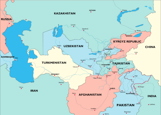
This is a compilation of the most useful maps of the Pamir Region.
If you have better sources for your travel purpose pleas let us know.
PRINTED MAPS
The best map of the Pamir Region is made by cartographer Markus Hause. This map includes trekking routes and, on the back, comprehensive information on the Pamirs. The third edition was published in August 2016.
“The Pamirs – a tourist map of Gorno-Badakhshan, Tajikistan, and background information on the region”
1:500 000, funded by the Swiss Agency for Development and Cooperation (SDC) and distributed by Gecko Maps
https://www.geckomaps.com
The map is also available at the following outlets:
Dushanbe:
Modigliani Art Salon / 4a Chekhov (Nissor Muhammed); Hotel “Tajikistan” (Souvenir shop); Hotel Serena; Souvenir shop “The Silk Route”; SDC Office
“Bactria” Centre
Khorog:
Lal Inn Guesthouse; Hotel Serena; Tourist Information / PECTA
Murghab:
Ibrahim Guesthouse; ‘Yak-House’ handicraft shop
Gecko Maps also publishes Markus Hauser’s 1:100,000 map “Lenin Peak”, of which a second edition was also published in July 2011.
KHOROG MAP PROJECT
A group of volunteers led by Stephane Henriod completed mapping the whole of Khorog, based on a high-resolution satellite image. The result can be seen here. It is still a work in progress and several features still need to be validated on the ground and others need to be added (street names etc).
RUSSIAN MILITARY MAPS
Detailed Russian military maps in the detail ranges 1:50,000 to 1:200,000 can be obtained (April 2012) against payment ($4 per map or $35 for the complete set of 402 maps) at https://www.mapstor.com/map-sets/country-maps/tajikistan.html. Clickable images at the bottom of the page enable you to select a specific map section.
N.B. Place names are in Cyrillic – the complete collection takes up 1.1 gB of memory.
UZBEK DEFENCE MAP
The 1:1,450,000 map published in 1992 by the Cartographic Centre of the Uzbek Ministry of Defence offers a good overview and gives most place names and accurate contours – N.B. it requires knowledge of Cyrillic characters. In 2003, the 1992 map was replaced with a more garishly coloured version published by the Tajik government mapping service: the new version is almost identical but adds population figures and surface area by district; place names are in larger print, a few more place names are given and generic terms (e.g. mountain range, peak) have been rendered in Tajik. In 2006 it was on sale at the bookshop near the Presidential Palace on Rudaki street in Dushanbe).
PILOT CHARTS AND OTHER MAPS
The 1:500,000 Tactical Pilot Charts available in the west (Stanfords in London) also give an overall idea, but despite their being a satellite map they are actually disappointingly inaccurate, and, due to the scale, also lack detail. There is also the limited-extent 1:200,000 map Pamir – Trans Alai Mountains, published by West Col Productions and available at Stanfords in London.
A list of map resources can be found on the GeoIdee website here, in particular the “Back-country Skiing Maps Tajikistan”.
A WORD OF WARNING
It might happen that maps are taken frim travellers by Tajik Border Forces or “KGB”.
LINKS
Links to websites with fairly good overview maps are given below. The following maps may also be useful.
Search the web using the terms Tajikistan and map, e.g.
https://www.lib.utexas.edu/maps/tajikistan.html
https://www.un.org/Depts/Cartographic/map/profile/tajikist.pdf
https://www.lonelyplanet.com
For historical maps, see https://www.angelfire.com/sd/tajikistanupdate/historicalmaps.htm
The in-depth master thesis about the energy situation in the Tajik Pamirs is a profound publication from the Universitiy of Bern also containg different maps.


